Places ·
A Land Shaped by Water: The Story of Merritt Island
Introduction
By Rebecca "Madam Chronicler" Ryan
Introduction
Merritt Island is one of Florida’s most remarkable places. It is a land caught between rivers, lagoons, and the Atlantic Ocean — a true water-shaped world. Its unique setting has created a place rich in history, wildlife, and culture. People have lived here for thousands of years, and every community that has called Merritt Island home has been connected to the water in some way.
This blog explores how water has shaped Merritt Island from its earliest Native American settlements to its role in today’s conservation and space exploration. It is a story about adaptation, survival, and the balance between humans and the environment.
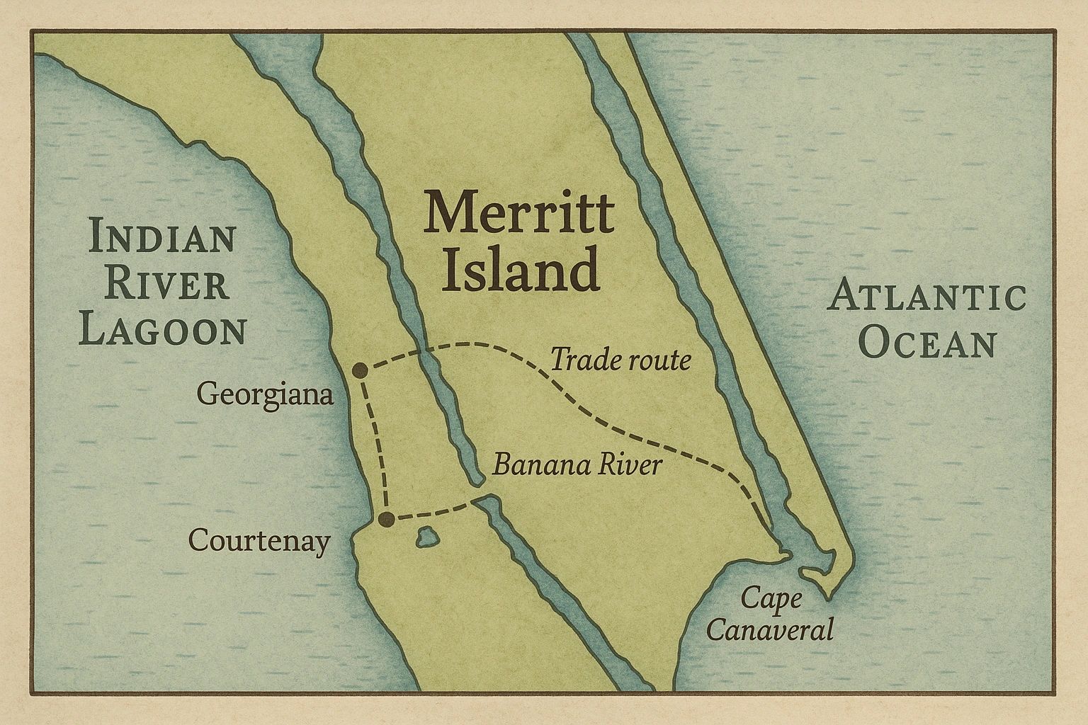
Geography: An Island Between Rivers
Merritt Island sits along Florida’s east coast in Brevard County, surrounded by the Indian River Lagoon on the west and the Banana River on the east. Though called an “island,” Merritt Island is technically a barrier island connected by causeways to the mainland and Cape Canaveral. The island stretches about 40 miles long and varies from 5 to 10 miles wide.
Its geography makes it unique. The Indian River Lagoon is one of the most biodiverse estuaries in North America, home to thousands of species of fish, birds, and plants. The mix of freshwater from rivers and saltwater from the ocean creates a perfect environment for life to thrive. Over thousands of years, the shifting sands, rising seas, and flowing rivers shaped the island into its modern form.
This watery environment provided food, transportation, and protection for the people who lived here long before European settlers arrived.
The Ais People: Florida’s River Tribe
Long before rockets or citrus groves, Merritt Island was home to the Ais people, sometimes called the “River Indians.” Archaeological evidence shows that the Ais lived along the rivers and lagoons for thousands of years. They built large shell mounds — some still visible today — made from discarded oyster, clam, and snail shells. These middens tell the story of their diet and way of life.
The Ais were expert fishers and gatherers. They relied heavily on the bounty of the lagoon — mullet, catfish, oysters, and turtles — as well as fruits, roots, and berries found in the surrounding hammocks. Canoes carved from logs carried them along the rivers, making travel and trade possible.
European explorers who first encountered the Ais in the 1500s described them as strong, tall, and resourceful. They had no need for agriculture because the land and water already provided everything they needed. Sadly, by the early 1700s, disease and conflict had nearly wiped out the Ais people. But their legacy lives on in the shell mounds and artifacts left behind, and in the names of rivers and places they once called home.
Early Settlers and Citrus Dreams
After centuries of relative isolation, Merritt Island began to change in the 19th century. European settlers and American pioneers arrived, drawn by the mild climate and fertile soil. By the mid-1800s, Merritt Island had become a hub for citrus farming. Oranges and grapefruits thrived in the sandy soil, and farmers shipped their produce up and down the river to northern markets.
The rivers were vital for transportation before roads and railways. Steamships carried fruit, supplies, and passengers along the Indian River, stopping at small docks and settlements. Communities like Courtenay, Georgiana, and Merritt Island Village grew around these waterways.
Life was not easy. Mosquitoes, hurricanes, and isolation tested settlers’ endurance. But the citrus industry gave Merritt Island a sense of identity and prosperity. Even today, citrus groves can still be found on parts of the island, a reminder of this important chapter.
The Water Highways of Trade
The Indian River and Banana River were not just sources of food; they were highways of trade and communication. In the 1800s, the Indian River Steamboat Line connected Merritt Island to towns along the lagoon and even to railroads that led north. Boats carried everything from pineapples and citrus fruit to timber and fish.
These water routes were the lifeblood of early Merritt Island. Farmers relied on them to sell their goods, while families used them to travel to church, school, or nearby towns. In many ways, the river was Merritt Island’s first road.
Natural Abundance: Wildlife and Ecosystems
Water shaped not only human life but also the rich ecosystems of Merritt Island. The rivers, lagoons, and wetlands created habitats for countless species. Early settlers and Native Americans alike marveled at the abundance of wildlife.
- Fish and Shellfish: Mullet, catfish, oysters, and clams were staples for centuries.
- Birds: Wading birds like herons, egrets, and roseate spoonbills thrived in the marshes.
- Mammals: Manatees glided through the rivers, while otters played along the banks.
- Reptiles: Alligators were — and still are — apex predators in the marshes.
This natural wealth made Merritt Island a special place long before it became a wildlife refuge. It also drew scientists and explorers eager to study its biodiversity.
The Civil War and Aftermath
During the Civil War, Florida supplied food and goods to Confederate troops. Merritt Island’s location made it a target for Union blockades, which disrupted trade and transport along the rivers. Many settlers abandoned their farms during the war, but after peace returned, the citrus industry bounced back stronger than ever.
The late 1800s brought new settlers from across the country, many seeking health and opportunity in Florida’s warm climate. Merritt Island grew slowly but steadily, with schools, churches, and small businesses forming close-knit communities.
20th Century Transformations
The 20th century brought enormous change to Merritt Island. The citrus industry remained important, but new forces began to shape the island. Roads, bridges, and railways reduced dependence on river transport. By the mid-1900s, Merritt Island was transitioning from a rural farming community to a place with national significance.
That transformation accelerated with the space race. In the 1960s, NASA selected nearby Cape Canaveral as its primary launch site. Large portions of Merritt Island were purchased for the Kennedy Space Center, and thousands of acres were set aside as a buffer zone. This land later became the Merritt Island National Wildlife Refuge, protecting ecosystems that had sustained life for millennia.
Thus, water’s shaping force continued, even in the modern era. The same rivers that once carried canoes and steamboats now reflected the fiery glow of rockets rising into the sky.
Cultural Legacy of Water
Water is not just a natural resource for Merritt Island; it is part of the island’s cultural identity. Festivals, art, and stories often reflect themes of rivers and the sea. Local cuisine — from fried mullet to clam chowder — highlights the bounty of the lagoon.
Generations of families recall fishing trips, boat rides, and childhood swims in the rivers. Even as the island modernized, these traditions kept people connected to the water. For many, Merritt Island is more than a place — it’s a way of life shaped by the rivers and lagoons that embrace it.
Conclusion
Merritt Island’s story is truly a story of water. From the Ais people who lived off the bounty of the lagoon to settlers who shipped citrus along the river highways, every chapter has been written by the island’s watery geography. Even today, water defines Merritt Island, whether through conservation efforts in the Indian River Lagoon or the reflection of rocket launches over the Banana River.
This land shaped by water is not just history — it is a living reminder of the balance between people and nature. Protecting Merritt Island’s waterways ensures that its story will continue for generations to come.
Bibliography
- Brech, A. (2016). Early Florida Indian River settlements: Life on the lagoon. Florida Historical Quarterly, 94(3), 321–345.
- Brock, R. J., & Reece, J. S. (2021). Conservation challenges in the Indian River Lagoon: A complex estuarine ecosystem under stress. Estuaries and Coasts, 44(5), 1243–1257. https://doi.org/10.1007/s12237-020-00884-1
- Gluckman, S. (2006). Shell mounds and middens of Florida’s east coast: The archaeology of the Ais people. Journal of Anthropological Archaeology, 25(4), 485–499.
- Mormino, G. R. (2005). Land of sunshine, state of dreams: A social history of modern Florida. University Press of Florida.
- Schmalzer, P. A. (1995). Biodiversity of saline and brackish marshes of the Indian River Lagoon: A threatened ecosystem. Bulletin of Marine Science, 57(1), 37–48.
- U.S. Fish & Wildlife Service. (2023). Merritt Island National Wildlife Refuge: Habitat, wildlife, and visitor activities. Retrieved from https://www.fws.gov/refuge/merritt-island
- Weisman, B. R. (2019). Pioneers of Florida’s Space Coast: The citrus era of Merritt Island. Florida Historical Society Press.
Originally published at the live site .